Archival Cartographies: Tracing the journeys and preserving the stories of refugees fleeing Nazi antisemitism and persecution
Miriam Silverman
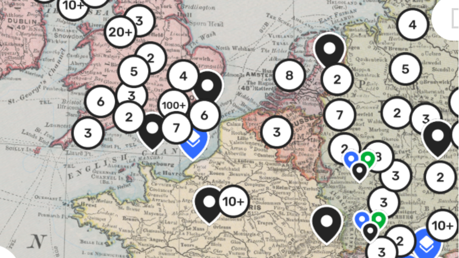
In December 2021, the Wiener Holocaust Library launched its Refugee Map on the Humap platform. This map tells the intimate stories of 200 refugees fleeing Nazi persecution in the 1930s and ‘40s, before, during and after the Second World War. In the same month, the news of hundreds of refugees arriving in Britain across the Channel made headlines, and today, thousands are fleeing war-torn Ukraine. Narratives of arrival are fraught with some of the same despair and hope. Journeys made under such extreme duress are impossible to imagine, but this map evocatively visualises those convoluted routes and to make the families and individuals that tread on them visible, along with the few items they carried. Within each record, pinned to the map can be found interviews and photographs, letters, reminiscences, official documents, as well as the stories of those who came - whether fleetingly or permanently.
The Wiener Holocaust Library is one of the world’s leading archives of the Holocaust. Founded by Dr Alfred Wiener in 1933, it supports learning and teaching about the causes and consequences of the Holocaust, aiming to be ‘a living memorial to the evils of the past by ensuring that our wealth of materials is put at the service of the future.’ The map serves that aim. Itsstructure makes it particularly good for serendipitous discovery and connection, a boon to researchers looking for records related to specific eras or subjects. There, you can easily find artists like Dorothy Bohm, a photographer, and Fritz Kormis, a sculptor. You can explore by filters such as Kindertransport stories, or records with video interviews. It makes for a highly immersive experience, moving from one person, one subject, one experience to the next across Europe and the world in time and space.
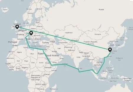
The Wiener Library has many more stories than the 200 presented on the map, but the sample is indicative of the whole. These are stories of survival, of huge movements, shown in vivid detail on the route maps. The hopping nature of refugees becomes clearer, moving from place to place. One example is the story of the Herczlinger Family from Vienna, who faced persecution and the loss of their income after Kristallnacht. David and Helene Herczlinger were able to send their children - Herman and Hilda - on the Kindertransport to the UK, while the rest of the family went the other way towards Shanghai. The family was finally reunited in the UK. in 1948. Shanghai, one of the few places that would accept Jewish refugees, saw an influx of around 20,000 between 1933 and 1941. David, Helene, and Helen’s siblings (Freda and Alfred) were only able to get on a boat to Shanghai because Freda had a boyfriend who was a captain on one of the ships of the Italian Lloyd Trestino Shipping Line.
The route of David and Helene (née Fischer) Herczlinger (Routes show the approximate journey across the map for a refugee family or family member). To view David and Helene’s story and the Collection associated with this route, click here.
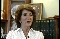
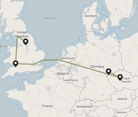
This sort of good luck and connection was often the difference between life and death, sometimes to the point of absurdity. Ruth Rogoff was saved when her mother gained two visas for her and her brother by winning a cooking competition at the British embassy. Ruth, her mother, and her brother left Prague on 30 August 1939 as if going on a day trip since they had no exit visa.
Photograph from the archive of Ruth Rogoff (née Biron)
The route of Ruth Rogoff (née Biron). To view the Ruth’s story and the Collection associated with this route, click here.
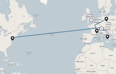
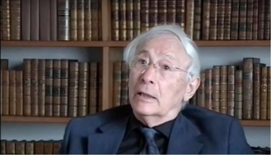
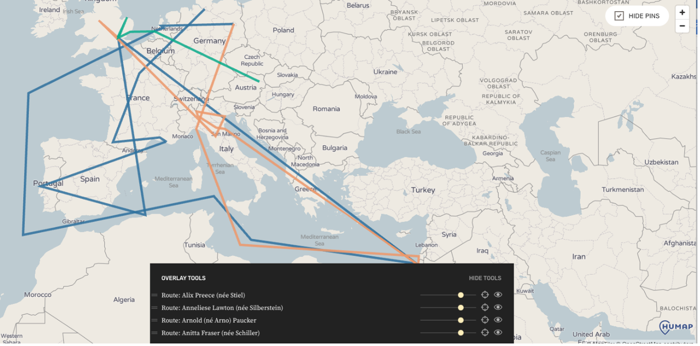
Although all the stories are heroic, some read like a Boy’s Own adventure. Kurt Paucker moved from Paris to the Massif Central with his school, but while most of the pupils ended up in the salt mines or the camps, he escaped and joined the French resistance, who promptly sent him on to Zurich. After the war, he toured Italy with his brother, who was in the British Army, by disguising himself in an officer’s uniform. Later, he left for the USA where he received his PhD, before finally settling in the UK. He went on to lead the Leo Baeck Institution in London. An extensive interview with him can be found in his record on the map, each part pinned to the relevant location he describes.
The route of Kurt Paucker. To view Kurt’s story and the Collection associated with this route, click here.
This long interview with Kurt can be found on the map, with records pinned to each leg of his journey.
The map routes are a marvel of succinct storytelling but when paired with the letters, photographs and passports, the hope and despair are more obvious. The IIIF-compatible viewer feature allows a deep zoom into the close written letters, typed official documents and photographic detail.
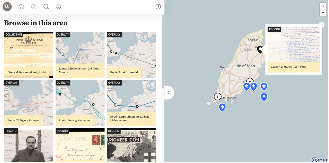
Letter from Else Kobylinski in 8 June 1940 to her family, detailing some of her experiences when she was arrested and interned on the Isle of Man. To find this letter in the Collection click here.
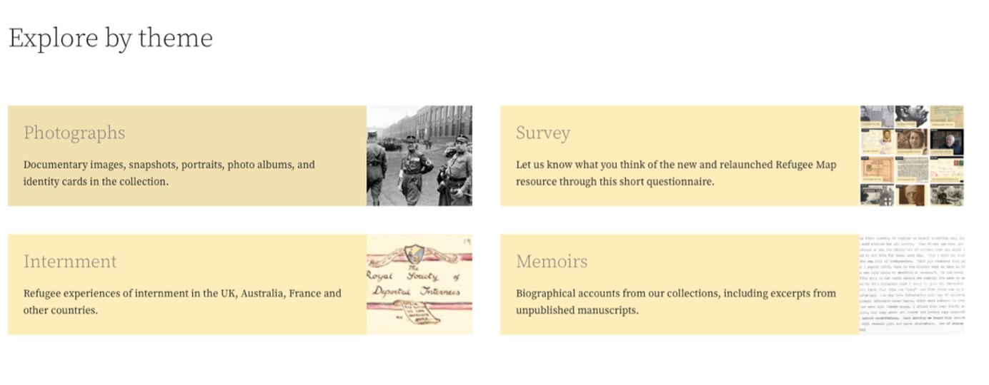
The addition of tags and collections helps the user to see at a glance everything associated with one theme or one person or family, especially as each person forms their own collection with their own attached records and routes. Links to the relevant parts of the Wiener Libraries’ catalogue are included, to help researchers go further if they wish. The map can also be explored thematically by artifact type such as photographs, documentary images, photo albums and identity cards and themes such as internment and memoirs in the form of biographical accounts from the collection including excerpts from unpublished manuscripts
An example of a themed collection: All the records, collections and routes associated with the Internment Camp on the Isle of Man. To explore the collection click here
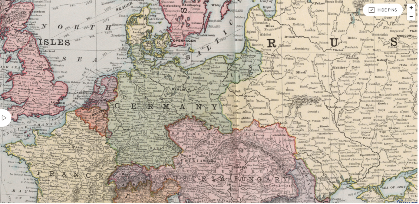
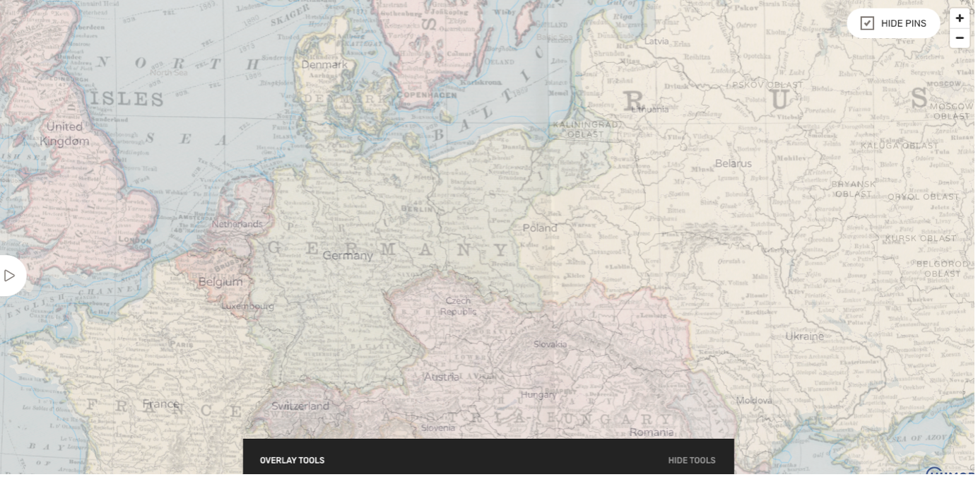
As well as the journey routes, the map is abundant in historic maps, geo-rectified over the base map. The 1912 map showing European borders is particularly useful for seeing the rise and fall of the great European powers over the past century. Poland’s loss and gain of lands since the war is very noticeable, along with the disappearance of the Austria-Hungarian empire.
Europe, from The Library Atlas of The World. Rand McNally & Company Publishers, Chicago, 1912.
Records from the collection visualised on the map overlay.
The modern map emerges from 1912 using the Map tool sliders. To view the 1912 map and use the overlay click here.
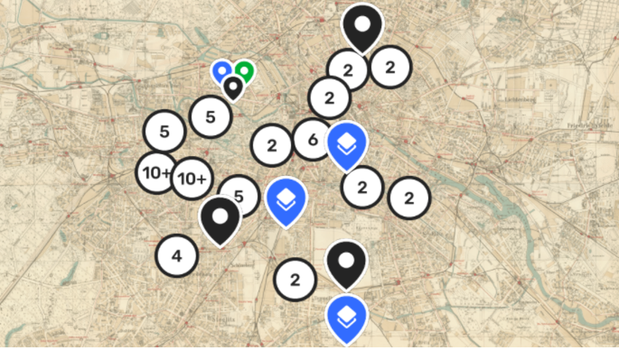
The 1940 city map of Berlin is also very useful in pinpointing pre-war residences before the city changed irrevocably.
Berlin 1940. Pharus-Plan Berlin Druckerei Gutenberg, Berlin N 54, 1940.
Records from the Collection visualised on the historic Berlin 1940 map overlay. To view the map and use the overlay click here.
Each map or route can be seen singularly or in conjunction with others, demonstrating what is so hard to comprehend from a single document, patterns, and connections.
As well as the map and its records, the new site provides ways for viewers to support the work of the Library, whether that’s through financial donation, volunteering or by the contribution of new stories and documents. Educational resources are also provided, from access to over 1,000 eyewitnesses accounts of Nazi persecution to educational tools about the Holocaustdesigned with the British school curriculum in mind.
The new map is designed to make research into the Jewish refugee story easy and immersive, allowing viewers to cut through quickly to the stories beneath. Such stories are unfortunately not part of the past; new refugees appear every day driven by persecution war and poverty. Their accounts are also important and perhaps they too will appear on their own map, the triumphant along with the tragic. Place is as much about remembrance as geography, to be able to point to a spot and say, “I once was here”.
For more information please visit:
